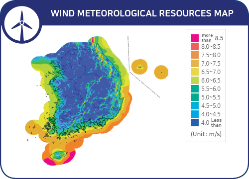
Wind meteorological resources map
The wind power meteorological resources map shows where the wind is strong in Korea. The wind speed is high mainly in mountain and coastal areas, Jeju Island, and the sea. Since wind speeds get stronger as the altitude increases, we develop the wind meteorological resources map for altitudes of 10, 50 and 80m above the ground.
Solar meteorological resources map
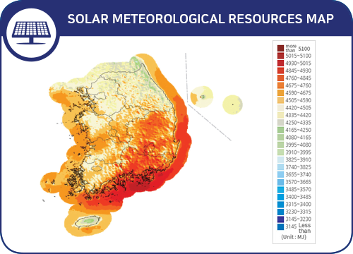
The solar meteorological resources map shows the strong sunlight(insolation) in Korea. It is mainly in the southern region, and has high insolation in the Gyeongsang Province, Jeolla Province regions and the southern coast of Korea. Since sunlight is transmitted directly and is scattered by air, we develop solar meteorological resources map such as direct, diffuse and global solar radiation.